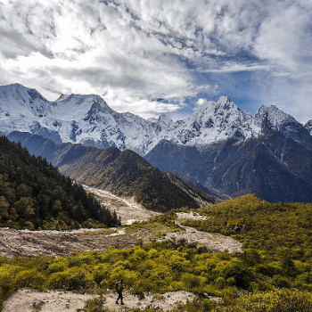
Manaslu Circuit Trek is one of the best off-the-beaten-path treks in Nepal. The peace and solitude in this trek are unlike any other destination in Nepal. The scenic views of Manaslu and other mountains including the Annapurna range are wonderful in the Manaslu Circuit Trek.
The Manaslu Circuit Trek lies above the foothills of the Gorkha District. You will encounter people of various ethnicities like Brahmins, Chhetris in the lower regions. But as you trek to the high altitude regions, you will meet Gurung people. The Gurungs of this region are adherents of Tibetan Buddhism.
You can see the influences of Tibetan Buddhism in various places along this trek. During your trek, you will get to various monasteries like Kargyu-Pemba Chholing Gompa, Labrang (Lama’s Place) Gompa, Pungyen Nunnery, etc. These monasteries let you explore the Buddhism of this region. These monasteries are also set beautifully amidst the mountains surrounding this region.
Manaslu Circuit Trek by Mount Mania starts after a scenic drive through the hills surrounding Kathmandu valley to Arughat and finally to Soti Khola. The trekking trails then take you along the gushing waters of Budhi Gandaki river.
The trail passes through several farmlands, bamboo, rhododendron, oak, and pine forests as you trek to the highest point of this trek in Larkya La pass. This pass is set at an altitude of 5125 meters. The pass is one of the best vantage points to view several mountains like Pawar Peak (6,620m/21,720ft), Cheo Himal (6,820m/22,376ft), the Himlung pyramid (7,126m/23,380ft), Gyaji Kung (7,030m23,065ft), Kang Garu (6,981m/22,905ft) plus Annapurna II (7,937m/26,041ft).
Choose Your Trek Duration
While our 12-day trek is the most recommended, we also offer customizable packages from 7 to 16 days depending on your time, fitness, and preferences.
Duration
Description
Link
7 Days
Short version of the Manaslu trek; suitable for fit and time-bound trekkers
One of the best places during the Manaslu Circuit Trek is the village of Samagaon. You will spend a day acclimatizing to this village. Exploration of this wonderful place includes the visit to the various Gompas as well as mountain viewing spots.
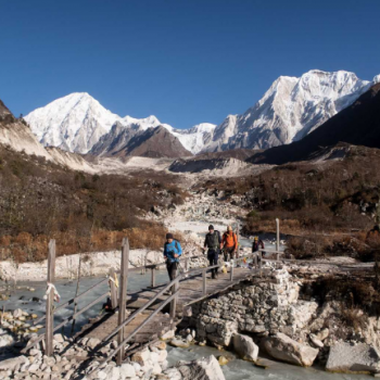
After crossing the Larkya La pass, you will descend into the dense forests of the Manaslu Conservation Area. You will cross some picturesque villages along the way like Samdo and Bimthang before finally getting to Dharapani. From Dharapani, you will take a bus ride to Kathmandu. You can also extend this trip to Tsum Valley.
Manaslu Trekking Permit Cost
Manaslu Restricted Permit Fee
Manaslu trek permit from September to November (Autumn) will cost USD 100 for the first seven days and USD 15 for each additional days Manaslu trek permit from December to August (Winter, Spring, and Summer) will cost USD 75 for the first seven days and USD 10 for each additional days
Manaslu Conservation Area Permit Fee
MCAP Entry Fee for SAARC: NRs.1000 per person MCAP Entry Fee for other nationals: NRs. 3000 per person
Annapurna Conservation Area Permit Fee (ACAP)
ACAP Entry Fee for SAARC: NRs. 1000 per person ACAP Entry Fee for other nationals: NRs. 3000 per person
It is not possible to do the Manaslu Trek without a guide because the area from Jagat to Bhimthang is a restricted zone. You can't go trekking by yourself; you have to be with at least one guide or porter who has a license from the government.
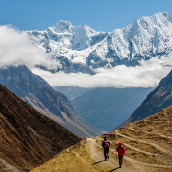
Mount Mania invites you to this culturally, as well as a natural, blessed place of Manaslu. Its fresh trekking trails with awesome landscape and an astonishing backdrop of mountains are every trekker’s delight.
12 Days Manaslu Circuit Trek Itinerary
Expand AllHide All
Day 1: Drive from Kathmandu to Soti Khola (160km / 8-9 hrs. 710m)
Today, you will head out to the starting point of your trek i.e. Solti Khola. You will take a bus from Kathmandu to Soti Khola. The route of the bus takes you along the Prithvi Highway. The road you through the middle hills till Malekhu. From Malekhu, a 30km road takes you north along the Trishuli river as you head towards Dhading Besi. A further 35-kilometer drive along a dirt road leads you to Arughat. As the road gets winding up to Gola Bhanjyang, you can see panoramic views Ganesh, Baudha and Manaslu Himal. A further 3 hours of ride leads you to Soti Khola. The bus ride up to Soti Khola is 8-9 hours.
Meals: Breakfast, Lunch & Dinner
Accommodation: Teahouse / Lodge
Distance: 160km / 8-9 hrs
Altitude: 710m
Day 2: Trek from Soti Khola to Maccha Khola (11km/ 5-6 hrs. 900m)
You will start your trekking journey today. The initial portion of today’s trek takes you along a gradual uphill through beautiful Sal forests. You will then walk past forested and terraced ridges and numerous waterfalls along the way. At times, the trail also narrows. You might also find yourself clinging to the sides of cliffs sometimes.
The trail then descends as you walk past rice paddies before climbing up to Labubesi (885m/2,800ft). From the village of Labubesi, you will trek to a suspension bridge Nauli Khola falls. You will then descend to gravel banks along the river before hiking gently up to Machha Khola village(900 meters). The trek from Soti Khola to Machha Khola is 6-7 hours long.
Meals: Breakfast, Lunch & Dinner
Accommodation: Teahouse / Lodge
Distance: 11km/ 5-6 hrs
Altitude: 900m
Day 3: Trek from Maccha Khola to Jagat (22km / 7-8 hrs. 1410m)
After breakfast, you will head out on a 6-7 hour trekking journey to Jagat (1410 meters). After crossing Machha Khola, you will trek gently up to the tiny village of Khorla Bensi. From there, you will get to the natural hot springs at Tatopani. This trail is also quite challenging.
After crossing a short forested path, you will reach a single teahouse at Doban. Above the village of Dobhan, Budhi Gandaki river descends rather impressively to a series of rapids. The river is quite calm beyond this steep slope. A further trek from Dobhan leads you to Lauri, where you will cross the river on a suspension bridge. Finally, you will climb on a high path to the fields of Jagat, where you will spend your night.
Meals: Breakfast, Lunch & Dinner
Accommodation: Teahouse / Lodge
Distance: 22km / 7-8 hrs
Altitude: 1410m
Day 4: Trek from Jagat to Deng (20km / 7-8 hrs. 1800m)
After breakfast at a teahouse in Jagat, you will embark on your trekking journey. A gentle uphill trek followed by a trek along level fields takes you to a suspension bridge over Budhi Gandaki. After crossing this suspension bridge, you will get to Philim. Philim is a large Gurung village that is home to small serene monasteries, stupas and prayer flags. You will have your lunch in Philim.
After lunch, you will trek through a flat leveled path. This path is inside pine and rhododendron forests. During the trek, you will also cross a few bridges that overlook quaint villages afar. After trekking for 6-7 hours from Jagat, you will arrive at Deng (1080 meters). Deng is home to a few houses. You can also enjoy an amazing waterfall lying at a small distance from Deng. This is an agricultural village that is famous for its potatoes, and buckwheat, barley, wheat, cabbage, & spinach.
Meals: Breakfast, Lunch & Dinner
Accommodation: Teahouse / Lodge
Distance: 20km / 7-8 hrs
Altitude: 1800m
Day 5: Trek from Deng to Namrung (19.5km / 7-8 hrs. 2630m)
Deng is a village that is the point of entry to Kutang or lower Nupri (part of Tibet until the 1840s): It is a primarily a Gurung settlement with the culture of Tibetan Buddhism. They have their own language. The trail from Deng takes you along a winding path to Rana. After trekking past a series of uphills and downhills, you will get to a log bridge. After crossing a tributary from the bridge, you will get to an isolated water mill. Then you will descend gently along the trail to Bihi Phedi, which lies high above the river.
Beyond Bihi Phedi, the trail descends as you cross the Serang Khola. Then, you will trek along a winding path that shapes up like an S. The path lies between sheer basalt walls. You can also see huge rocky crags to the right. You will also have splendid views of the waterfall above the maize and wheat fields. As you trek towards the northeast direction, the valley broadens. After trekking past a bridge and mani stone walls, you will reach the attractive village of Ghap (2,250m/ 7,382ft). Past the village of Ghap, you will trek through bamboo, rhododendron and oak forests. On some days, you can also see birds like Impeyan pheasant (also known as Himalayan Monal)
This trail is above the steep descent of the river. For a short duration of time, you will trek to the north bank. Then you will head back towards the southern bank after crossing a bridge. After trekking for one hour from the bridge, you will reach Namrung. Namrung also has a police checkpoint for permits. Just before you get to Namrung, the trail overlooks Tum Khola from Tibet. This adds to the volume of water in Budhi Gandaki in the confluence. The trek from Deng to Namrung (2630 meters) is 6-7 hours long.
Meals: Breakfast, Lunch & Dinner
Accommodation: Teahouse / Lodge
Distance: 19.5km / 7-8 hrs
Altitude: 2630m
Day 6: Trek from Namrung to Samagaon (18km / 7-8 hrs. 3530m)
Namrung is a Tibetan village and serves as an entrance to Upper Nupri. As you trek past a mix of forest and barley fields, you will reach Lihi. You can see impressive chortens as well as great views of Himal Chuli (7,893m/25,897ft) and Ganesh Himal. The trail then descends before entering a valley as you cross the Hinang Khola. After crossing Hinanag river on a bridge, you will trek along a steep uphill to a chorten, which offers spectacular views of Ngadi Chuli (7,873m/25,831ft).
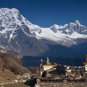
As you trek further up a steep ridge, you will reach Lho. You can also visit a large monastery called Ribung monastery in Lho. You will then trek down a steep uphill before you reach Damonan Khola tributary. After trekking past a plateau, you will get to Shyala village (3,520m/11,549ft). Shayala overlooks many beautiful peaks like Himal Chuli (7,893m/25,897ft), Peak 29 (Ngadi Chuli, 7,873m/25,831ft); and Manaslu (8,156m/26,760ft).
As you continue trekking, you will get to a bridge over Numla Khola. The trail then takes the left of Pungyen Gompa. After trekking for 6-7 hours from Namrung, you will get to Samagaon (3530 meters). Kargyu Chholing Monastery stands against a forested moraine around the edge of this village. From Samagaon, you can only see the upper sections of Manaslu and the Naike ridge.
Meals: Breakfast, Lunch & Dinner
Accommodation: Teahouse / Lodge
Distance: 18km / 7-8 hrs
Altitude: 3530m
Day 7: Trek from Samagaon to Pungyen gompa. Then Back to Samagaon (5/ 6 hrs. 3870m)
Today, you will explore the village of Samagaon, which is the regional center of Nupri. You will also get to know about the culture and architecture in the region: only potatoes and barley flourish in the short summers at this altitude. Most of the people in this village weave clothes from sheep or Tibetan imported wool. They are also involved in the manufacture of hooked rugs for trade with Tibet.
You will visit the Labrang (Lama’s Place) Gompa and the Kargyu Chholing Monastery in Samagaon, The history of these monasteries dates back some 500 years ago. Many people ascribe the history of these monasteries to its earlier Tibetan settlers. The monastery has impressive wooden carvings. All in all, there are eight temple buildings. The largest of them is the Pemba Chholing Gompa. It is home to an impressive statue of Guru Rinpoche.
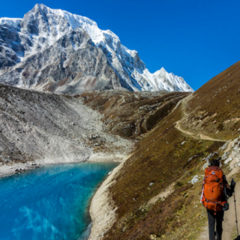
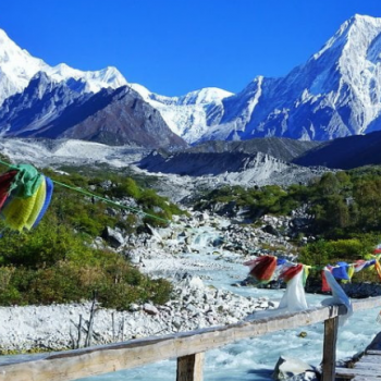
A gentle hike past the monastery leads you to Birendra Tal (3,450m/11,319ft). This lake lies below Manaslu Glacier. You can also trek for close to 3 kilometers to get to a hilltop or a stony beach which offers wonderful views of Manaslu. You can also follow a trail towards Samdo to a bridge over the stream from the lake. After trekking for 5-6 hours, you will get to Manaslu Base Camp.
You can also trek to Pungyen Nunnery (3,870m/12,697 ft). It lies above Pungyen Glacier. You can get sumptuous views of the Nadi ridges and Manaslu from near the gompa.
Meals: Breakfast, Lunch & Dinner
Accommodation: Teahouse / Lodge
Distance: 5/ 6 hrs
Altitude: 3870m
Day 8: Trek from Samagaon to Samdo (8.5km / 3-4 hrs. 3860m)
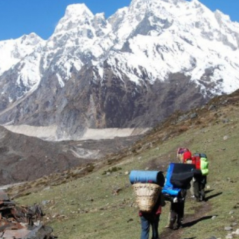
The initial part of today’s trek descends towards Budhi Gandaki. The trail is in the north towards the lake. You will walk along the Base Camp trail as you encounter several mani walls as the valley widens. The trek is relatively easy and lies a shelf above the river. You will walk past the forests of juniper and birch which surround Kermo Kharka. The trail then descends to a wooden bridge as you cross the Budhi Gandaki river.
Then you will trek along a steep uphill to a ridge that lies above the confluence of Budhi Gandaki and Mayol Khola. You will encounter a stone arch, and fields before you get to the entrance of the village. Although the place is an attractive one, it is primarily a yak and goat herding area. The village only turned out as a settlement in the late 1950s when Tibetans fled Tibet.
As you trek past these fields, you will get to several sets of flags on a high ridge. Here, you can catch superb panoramic views of Samdo Peak (6,335m/20,785ft) and its glacial basin, the Sama Valley, Manaslu range, Syacha Glacier, Dharamsala, and Larkya La pass. After trekking for 4-5 hours from Samagaon, you will reach Samdo (3860 meters). Samdo is the last village before Gho, in the Manang District. Only informal kharkas (with lodges) lie between these villages.
Meals: Breakfast, Lunch & Dinner
Accommodation: Teahouse / Lodge
Distance: 8.5km / 3-4 hrs
Altitude: 3860m
Day 9: Trek from Samdo to Dharamsala (6.5km / 3-4 hrs. 4460m)
You will trek past the fields in the northern village as you cross the Budhi Gandaki the final time. This will take place in the Larkya Bazaar site. The flow of the river takes it to the Pana Danda Valley in the north. You will then take the westward trail. You will trek past grassy slopes with scrub juniper, rhododendron and lichen covered granite. This trail is just above the Syacha Khola Valley. Along the way, you can also see the origin of Syacha Glacier, which descends from the Manaslu North ridge.
The trail works heads towards the Larkya Glacier. After trekking past the Larkya La Phedi, you will get to a settlement called Dharamsala (4460 meters). Today’s trek from Samdo to Dharamsala is 4-5 hours long. A short walk from your guesthouse will take to a place with better views of the Larke (6,249m/20,503ft) and Naike (6,291m/20,641ft) peaks.
Meals: Breakfast, Lunch & Dinner
Accommodation: Teahouse / Lodge
Distance: 6.5km / 3-4 hrs
Altitude: 4460m
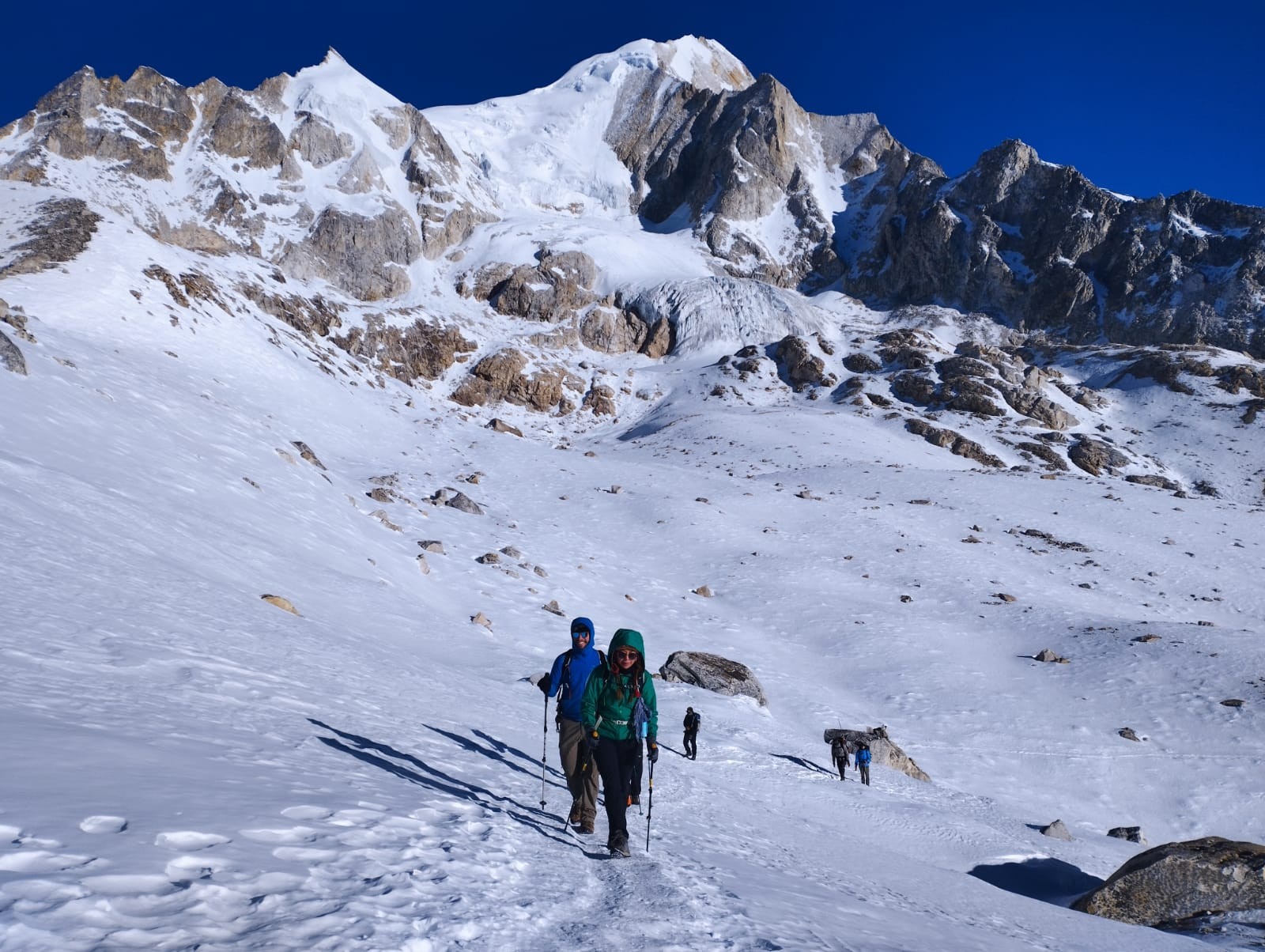
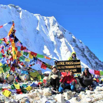
Day 10: Trek to Bhimthang via Larkya La Pass (24.5km / 8-9 hrs. 3720m)
Today you trek for 3-5 hours to ascend 800m/2,600ft to get to Larkya La Pass (5160 meters). You will then descend for 3-4 hours losing 1,500m/4,900 in altitude to get to Bimthang(3720 meters). If the wind blows, it can get really cold along the way. You have to be extra careful if you encounter ice and snow along the way.
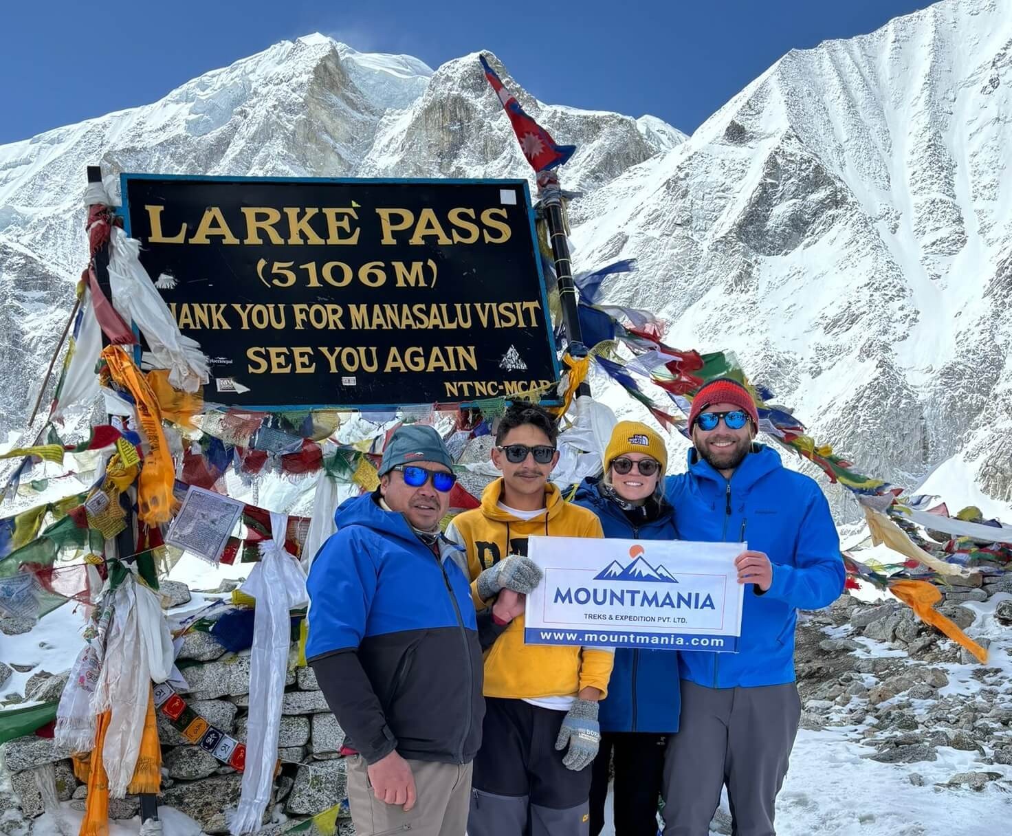
The trekking trail from Dharamsala takes you along a gentle ascent to a ridge. Then will be a long gentle climb to the moraine. The trail along the northern moraine of the Larke Glacier is not quite steep. However, the trek is quite long and rocky. So you might find this a bit challenging. From the glacier, you can see the Larke Peak (Larke Himal) and Pawar Peak (Cheo Himal) on the south and north of the glacier respectively.
From the pass, you will trek uphill to an ablation valley. The trail then drops down to the first of four small scattered frozen lakes. As you trek uphill to the glacial moraine from the left, you will get to the first set of summit flags. The trail overlooks the Tibetan border ranges beyond Samdo Peak on the eastern side. There is a long moraine-ridge that is parallel to the Larke wall. A set of flags separates the Larke Wall. These flags are the markers of the border between the Manaslu and Annapurna Conservation areas.
This place is a wonderful point to see the various peaks like Pawar Peak (6,620m/21,720ft), Cheo Himal (6,820m/22,376ft), the Himlung pyramid (7,126m/23,380ft), Gyaji Kung (7,030m23,065ft), Kang Garu (6,981m/22,905ft) plus Annapurna II (7,937m/26,041ft).
After spending some time in Larkya La pass, you will start your descent begins from these prayer flags. The trail descends steeply from the moraine. Then you will get to a set of steep zigzags until you reach Dangboche Kharka (4,450m/14,600ft). The trail from Dangboche Kharka is not really steep. The trail winds along the lateral moraine of the Salpudanda/Bimthang glacier before getting to Bimthang Valley.
Meals: Breakfast, Lunch & Dinner
Accommodation: Teahouse / Lodge
Distance: 24.5km / 8-9 hrs
Altitude: 3720m
Day 11: Trek from Bhimthang to Dharapani (22km / 7-8 hrs. 1860m)
Bhimthang is a beautiful settlement that gives you views of the Kechakyu Himal on the north and Manaslu’s northeast face. Bhimthang serves as a settlement of the people of Samdo village in the summer season. It was also an important trading post before the border to Tibet closed down. It was also a center of the Tibetan Khampa warriors around 1970.
Today’s trek begins as you walk past the Bimthang Plain. You will descend along a trail to cross the stony glacier before heading up a moraine to enter rhododendron and pine forest. All along this route, you will get wonderful views of Larke, Manaslu, Nadi and Chuli Himals. As you descend further, you will get to Hompuk and Sangura Kharka before reaching Karche. From Karche, you will trek past terraced fields and a steep uphill until you reach Gho.
The trail from Gho takes you through farmlands to Tilje (2,300m/7,546ft). From there, you will descend rapidly towards the Marsyangdi Valley in Thonje (1,965m/6,447ft) You will then join the new road along the main Annapurna Circuit route in Dharapani(3560 meters). Today’s trek is 5-6 hours long.
Meals: Breakfast, Lunch & Dinner
Accommodation: Teahouse / Lodge
Distance: 22km / 7-8 hrs
Altitude: 1860m
Day 12: Drive from Dharapani to Kathmandu or Pokhara (8-9 hrs. 1320m)
Today, you will head back to Kathmandu. You will follow the Prithvi Highway en route to Kathmandu. To reach our destination, we need to drive for about 7-8 hours by jeep and 9-10 hours by local bus. On the way, you can view natural waterfalls, rice-field, local house, forest, and streams.
Three meals a day (12 Breakfast, 12 Lunch, and 11 Dinner) during the trek
Local Bus Ticket (Kathmandu to Soti Khola)
Local Bus Ticket (Dharapani to Kathmandu)
12 days English Speaking Trekking Guide with Insurance, Transportation, Food and Accommodation
All Trekking Permits (ACAP, MCAP and Manaslu Special Permit)
Daily seasonal fresh fruits after dinner
Use of sleeping bag & Duffel bag (if you don’t have your own, To be return after trip completed).
A first aid kit carried by the guide (Oximeter to measure your oxygen and pulse in high altitude)
All Government and Local taxes
Cost Excludes
International Flight Ticket and Nepalese Visa Fee
Hotel & Meals in Kathmandu
Extra night accommodation in case of early arrival, late departure, and early return from the trek (due to any reason) than the scheduled itinerary
Personal expenses (WiFi, Phone calls, Laundry, Bar bills, Battery Recharge, Water, Shower, and Tea / Coffee)
Other costs not mentioned in 'Cost Includes' section
Travel and Rescue Insurance
Tips for Guides, Porters, and Drivers
Optional
Private jeep Kathmandu to Machha khola USD220$
Private jeep Dharapani to Kathmandu to USD250$
Kathmandu Hotel Per Night Twin Sharing On BB USD 60$
Useful Information
Weather
Altitude Profile
Manaslu Circuit Trek Difficulty
The total length of the Manaslu Circuit trek is around 177 kilometers. You will be trekking for 10 days covering a distance of 15-20 kilometers every day.
Another factor that determines the difficulty of this trek is the uphills and downhills you will encounter along the way. Many times as you trek along the Budhi Gandaki river, the trek can be harrowingly steep. The trek up to Larkya La Pass is also quite challenging.
Manaslu Circuit Trek takes you to the highest altitude of 5,213 meters in Larkya La Pass. The altitude is high enough to incite altitude sickness. The trails also can get quite breezy making the trails quite cold.
Taking all of these things into consideration, the Manaslu Circuit Trek is a strenuous trek. As a result, you will have to be quite fit in order to complete this trek. 2-3 months of physical preparation will be necessary for you to complete this trek.
Manaslu Circuit Trek Best Time
Autumn (September, October, and November) is the most popular time for the Manaslu Circuit Trek. Autumn offers the most beautiful views of Manaslu as well as other mountains in the Annapurna Range.
Spring (March, April, and May) is the second most popular time for the Manaslu Circuit Trek. The rhododendron forests of the Manaslu Conservation Area light up beautifully in this season. The low rainfall in this season is another reason for the popularity of the spring season.
As you will trek to an altitude of more than 5000 meters in the Manaslu Circuit Trek, the trek can be quite cold in the winters (December, January, and February) with temperatures going as low as -20 degrees C. In the summer season (June, July, and August), the trails can be quite wet with the monsoon. So you will have to pack and prepare extremely well to trek in these two seasons.
Getting a visa for Nepal is relatively straightforward. You can obtain a visa upon arrival at Tribhuvan International Airport in Kathmandu or at land border crossings. Alternatively, you can apply for a visa at a Nepalese embassy or consulate in your home country. Ensure you have a valid passport with at least six months of validity, a passport-sized photo, and the required visa fee in USD.
How challenging is the Manaslu Circuit Trek?
The Manaslu Circuit Trek is considered challenging, suitable for trekkers with good physical fitness and some trekking experience. The trek involves steep ascents and descents, high altitudes, and the crossing of the Larkya La Pass at 5,160 meters. Proper acclimatization and preparation are essential to handle the demands of this trek.
What services are included in the Manaslu Trekking package?
Trekking packages for the Manaslu Circuit typically include:
Airport transfers
PublicTransportation to and from the trailhead
Accommodation in tea houses during the trek
Meals during the trek (breakfast, lunch, and dinner)
Licensed trekking guide and porters
Necessary permits (Manaslu Restricted Area Permit, Manaslu Conservation Area Permit, and Annapurna Conservation Area Permit)
First aid kit
Is travel insurance required for trekking in the Manaslu Region?
Travel insurance is mandatory for the Manaslu Region Trek. The insurance should cover high-altitude trekking, emergency evacuation, medical expenses, and trip cancellation. Ensure your policy includes coverage for altitudes up to 6,000 meters.
Who will pick us up from the airport?
Our Mount Mania representative will meet you at Tribhuvan International Airport upon your arrival and transfer you to your hotel in Kathmandu.
What is the best time to trek to Manaslu?
The best times to trek the Manaslu Circuit are during the pre-monsoon (March to May) and post-monsoon (September to November) seasons. These periods offer stable weather conditions, clear skies, and excellent views of the mountains.
Is there internet service available during the Manaslu Circuit Trek?
Internet service is available in some tea houses along the Manaslu Circuit, but it can be slow and unreliable. It is advisable to inform your family and friends that communication may be intermittent during the trek.
Is it safe to drink running water on the Manaslu Trek?
You should not drink untreated running water on the Manaslu Trek. Bottled water is available, but it is recommended to use water purification tablets or filters to treat water from local sources to reduce plastic waste and ensure safe drinking water.
Can I use credit cards in the Manaslu Region?
No, you can't used credit card in the Manaslu Region. It is advisable to carry enough cash (Nepalese Rupees) to cover your expenses during the trek, as ATMs are scarce along the trail.
What is the highest peak in the Manaslu Region?
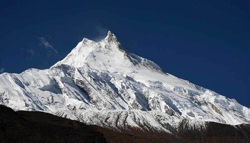
The highest peak in the Manaslu Region is Mount Manaslu, standing at 8,163 meters (26,781 feet). It is the eighth-highest mountain in the world.
Is Larkya La Pass very difficult for beginner trekkers?
The Larkya La Pass is one of the most challenging sections of the Manaslu Circuit Trek. It is difficult for beginner trekkers due to its high altitude and steep ascent. Adequate preparation, acclimatization, and physical fitness are crucial for crossing the pass safely.
Can I trek in the Manaslu Region alone?
Solo trekking in the Manaslu Region is not allowed. Trekkers must be accompanied by a licensed guide and be in a group of at least two people, excluding the guide. This regulation ensures safety and supports local tourism.
What is the cost of permits for the Manaslu Circuit Trek?
The cost of permits for the Manaslu Circuit Trek includes:
Manaslu Restricted Area Permit: USD 70 for the first seven days and USD 10 for each additional day (from September to November); USD 50 for the first seven days and USD 7 for each additional day (from December to August)
Manaslu Conservation Area Permit: USD 30 per person
Annapurna Conservation Area Permit: USD 30 per person
What is the highest altitude we will reach during the Manaslu Circuit Trek?
The highest point reached during the Manaslu Circuit Trek is the Larkya La Pass, which stands at 5,160 meters (16,929 feet). This altitude requires careful acclimatization and preparation to avoid altitude sickness and ensure a successful trek.
How should I apply for Manaslu Trekking Permit?
Manaslu Trekking permit must be applied through the professional trekking agency which must be legally registered under the Nepal government act. Contact us to apply fo Special permit.
Can I apply for Manaslu trek permit individually?
This is one of the most common questions that most of the trekkers’ ask. But, you can not apply individually for Manaslu trekking permit. Minimum of two trekkers is required to apply for Manaslu special permit from one of the professional trekking agency.
Note: If you are planning Manaslu Trek individually, contact us we will find out other trekkers to join.
Do we need a guide and porter for Manaslu trekking?
As we know, the Manaslu region is located in the restricted area, the Nepal government and concerned authorities have made compulsory to have one licensed holder professional guide. Whereas, taking porter is optional. Another major reason behind taking guide is for easy communicating with the local people in a village. The guide will also provide information about the authentic culture around Manaslu region.
What's the weather look like in Manalsu?
At the start of the trek the climate is subtropical. Overall you can expect somewhere between 10 to 25 Celsius throughout the year. However in the upper parts of the trek the temperature will fall to -20 or below in the winter.
Feel free to contact us, if you are a planning a trip to Manaslu Trek, we will help you to create a customized itinerary on your specified month and cost.
Highly recommend this trip! A friend recommended it to me, and I complete understand why. Landscapes are just insane. Ganesh was a great guide, took lots of care of us and adapted the trip to our wishes and needs. Price is also really fair taking into account that everything is included.
My partner and I had the most amazing experience on the Manaslu Circuit Trek in April 2024. We can't thank Mount Mania team enough for taking us on this truly unforgettable adventure. Over 14 days, we journeyed through the Nepalese Himalayas and crossed over the Larke Pass at an elevation of 5106 meters!
The trek had some of the most stunning landscapes we have ever seen. Each day brought new vistas even more breathtaking than the last. The panoramic views from the Larke Pass were a highlight, offering an unparalleled sense of accomplishment and awe. One of the most enriching aspects of the trek was the opportunity to immerse ourselves in the local culture. The teahouses provided a cozy and authentic experience, with delicious home-cooked meals and a chance to learn about the local customs and way of life.
The trek was challenging but incredibly rewarding. The trail was varied, with some steep ascents and descents, river crossings, and suspension bridges. And let's not forget our mountain friends - the beautiful mules, we passed many on this trek. The gradual acclimatization was well-planned, ensuring we were well-prepared for the high altitude of the Larke Pass. Our guide, Ganesh, was knowledgeable and supportive, providing us with invaluable information about the region and ensuring our safety and comfort throughout.
Tips for Future Trekkers:
Physical prep: Make sure to be in good physical condition before attempting the trek. The altitude and duration require a reasonable level of fitness.
Packing: Pack light but ensure you have essential gear for cold weather, particularly for the higher altitudes. A good pair of trekking boots is a must.
Acclimatization: Take this process seriously to avoid altitude sickness. Listen to your guide and your body.
Guided vs. Independent Trekking: We highly recommend going with a guide. Mount Mania are a wonderful team and their knowledge and support are invaluable, particularly in remote areas.
The Manaslu Circuit Trek was a life-changing adventure that exceeded our expectations. The combination of natural beauty, cultural richness, and the sense of achievement made it an experience we will cherish forever. If you're looking for a challenging yet incredibly rewarding trek in Nepal, the Manaslu Circuit should be at the top of your list!
We had an amazing experience with such beautiful views and great memories. Our guide helped us along the way, explained all the necessary details and told us a lot about our trek and Mount Manaslu.
I would definitely recommend you to book a trek tour with Mount Mania Treks if you love to see beautiful places and want a professional but also a really fun guide along the road!
Our trek around Manaslu was breathtaking in the truest sense of the word. The great exertion caused by the altitude was compensated for by the magnificent scenery and fantastic weather. The organization by Mountmania was perfect! Everything went very smoothly.
Our guide Ganesh was extremely experienced and made every effort to make the trek as pleasant as possible.

.png)
.png)